Call or Text

Hell’s Revenge Trail, Moab
Hell’s Revenge is Moab’s most famous slickrock trail: about 6.5 miles of steep sandstone fins, ledges and big views just minutes from town. It runs through the Sand Flats Recreation Area and has been named a National Recreation Trail.
| Where | Sand Flats Recreation Area, just east of downtown Moab, Utah |
|---|---|
| Length | About 6.5 miles; plan 2 to 3 hours |
| Difficulty | Difficult, with optional obstacles like the Escalator, the Tip-Over Challenge and Hell’s Gate |
| Fees | A Sand Flats Recreation Area fee is paid at the entrance station |
| Trail markings | Follow the route painted on the rock; the Slickrock Bike Trail (white dashes) is for bikes and motorcycles only |
| Best seasons | Spring and fall |
Open the full trail mapBase map: Natural Earth
Where it is
Hell’s Revenge
- StartHell’s Revenge trailhead, just past the Sand Flats entrance station
- GPS38.575317, -109.522583
- DriveAbout 3 hr 30 min from our Orem location
- LevelDifficult
Booking online is the fastest way to check availability. Call or text us to plan a Hell’s Revenge ride.
Riding Hell’s Revenge
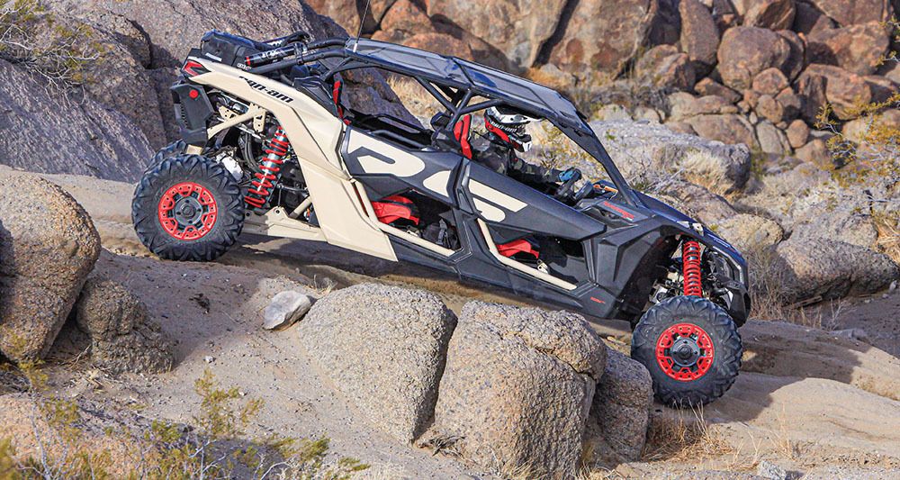
The trail starts just past the Sand Flats entrance station and climbs onto a sea of Navajo sandstone. From the high points you can see the La Sal Mountains, the Colorado River gorge and the rock of Arches National Park. Much of the ride is up and over fins so steep you see only sky over the hood.
The hardest obstacles have bypasses, so you can choose your own level. Hell’s Gate and the Tip-Over Challenge are for experienced drivers with a spotter, and there’s no shame in watching from the side. Stay on the painted route; the living soil crust beside the rock takes decades to recover.
Tips for the trail
- Use low range and go slow on the steep climbs and drops.
- If you can’t see over a ledge, walk it before you drive it.
- Watch for mountain bikers where the trail crosses the Slickrock Bike Trail.
- Summer days on the rock get very hot; ride early.
Hell’s Revenge UTV rentals
- A Maverick X3 X RC or Maverick X3 MAX has the clearance and low range slickrock calls for. Your machine can meet you at the riding area. Call or text us to plan the trip.
- Want someone who knows the way to lead? Add a guide to your rental.
- Helmets and goggles are included. Fuel and taxes are additional, and the damage waiver is optional.
- Drivers must be 18 or older with a valid driver’s license, and every driver completes Utah’s free online OHV education course. Passengers of any age can ride with a guardian’s approval.
Hell’s Revenge questions
Is Hell’s Revenge good for beginners?
It’s rated difficult, but the biggest obstacles have bypasses. First-time drivers may want to start with Fins N Things or Gemini Bridges, or add a guide.
How long does Hell’s Revenge take?
Most groups take 2 to 3 hours for the 6.5 miles, longer if you stop to watch the obstacles.
Do I need a pass?
Yes. The Sand Flats Recreation Area charges a fee at the entrance station.
More rides nearby: Fins N Things, Gemini Bridges, Moab, San Rafael Swell. Compare them all in our Utah trail finder.
Ready to ride Hell’s Revenge? Book online, or call or text us with questions.
Before you ride
Get Ride Ready
Take the free Utah OHV course, read our riding rules and check what to bring before pickup.
Get Ride ReadyNo signal out there?
Save the trail map and Trail Help to your phone now. They open with no bars, and your blue dot still works.
Weather near Hell’s Revenge
Loading the forecast…