Call or Text

Poison Spider Mesa Trail, Moab
Poison Spider Mesa is one of Moab’s classic slickrock trails, climbing from the Colorado River onto a high mesa with views over Moab and the La Sal Mountains. Steep switchbacks, the famous Waterfall obstacle and a loop across open slickrock make it a favorite for experienced drivers.
| Where | Potash Road (Highway 279), about 6 miles from US-191; turn at the “Dinosaur Tracks” sign |
|---|---|
| Length | About a 16-mile route, out and back to a loop on top of the mesa |
| Difficulty | Difficult, with the Waterfall, steep ledges and sharp switchbacks |
| Highlights | Dinosaur tracks near the trailhead, Little Arch at the rim and views of Jeep Arch |
| Fees | No fee at the trailhead; it’s day use only |
| Best seasons | Spring and fall |
Open the full trail mapBase map: Natural Earth
Where it is
Poison Spider Mesa
- StartPoison Spider Mesa trailhead on Potash Road (Highway 279)
- GPS38.533508, -109.607605
- DriveAbout 3 hr 30 min from our Orem location
- LevelDifficult
Booking online is the fastest way to check availability. Call or text us to plan a Poison Spider Mesa ride.
Riding Poison Spider Mesa
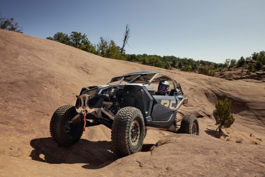
The trail climbs switchbacks from the trailhead and follows the tilted rock layers up toward the rim. A few miles in, the Waterfall is a winding set of slickrock ledges that tests your line choice, and optional climbs like the Prelaunch Pad add extra challenge. On top, the loop crosses open slickrock to Little Arch, perched near the cliff edge above the river.
The first miles are driven both ways, so if an obstacle looks like too much, you can turn around. The Golden Spike trail branches off the top of the mesa and is far more extreme, so stay on the Poison Spider loop unless you’re ready for it. Mountain bikers share this trail, so drive with care.
Tips for the trail
- Use the pullouts along Potash Road for trailers; the trailhead lot is small.
- Pick your line on the Waterfall before you start up it.
- Stay on the Poison Spider loop; Golden Spike is for extreme rigs.
- Watch for mountain bikers, especially on the climbs.
Poison Spider Mesa UTV rentals
- A Maverick X3 X RC or Maverick R has the clearance and suspension this trail calls for. Your machine can meet you at the riding area. Call or text us to plan the trip.
- Want someone who knows the way to lead? Add a guide to your rental.
- Helmets and goggles are included. Fuel and taxes are additional, and the damage waiver is optional.
- Drivers must be 18 or older with a valid driver’s license, and every driver completes Utah’s free online OHV education course. Passengers of any age can ride with a guardian’s approval.
Poison Spider Mesa questions
Where is the Poison Spider Mesa trailhead?
On Potash Road (Highway 279), about 6 miles from US-191. Turn at the “Dinosaur Tracks” sign and drive up to the parking area.
Is Poison Spider Mesa hard?
Yes. Steep switchbacks and the Waterfall make it a difficult trail. Add a guide if you’re new to slickrock.
Is there a fee for Poison Spider Mesa?
No. There’s no fee at the trailhead, and it’s for day use only.
More rides nearby: Long Canyon, Gemini Bridges, Hell’s Revenge, Moab. Compare them all in our Utah trail finder.
Ready to ride Poison Spider Mesa? Book online, or call or text us with questions.
Before you ride
Get Ride Ready
Take the free Utah OHV course, read our riding rules and check what to bring before pickup.
Get Ride ReadyNo signal out there?
Save the trail map and Trail Help to your phone now. They open with no bars, and your blue dot still works.
Weather near Poison Spider Mesa
Loading the forecast…